For your home and the places you love. From the National Hurricane Center. Free, with no ads.
Free
No ads
No account
Coming soon to iPhone
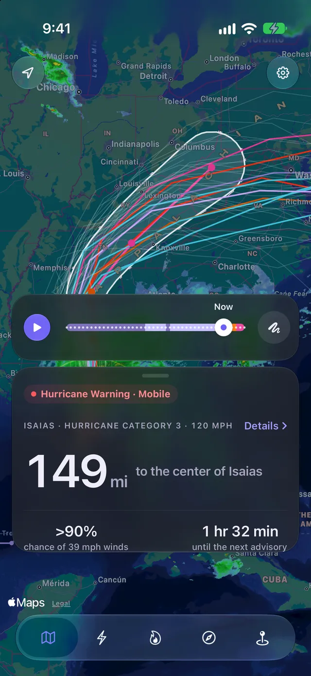
From NHC's latest advisory
149mi
to the center of Isaias, from Mobile
Hurricane, 120 mph, moving 20 mph NNE
Hurricane Warning in Mobile
Live
Every storm being tracked, right now.
Answers, not maps.
Places
When does the wind reach me?
The hour 39 mph gusts start, when they pass 58, and the worst of it. With sunset, so you know how much daylight is left. All in the place’s local time. For places in the United States.
An example: Mobile, AL, during Isaias, Oct 9, at 1 PM. Times CDT. Source: National Weather Service.
Storms
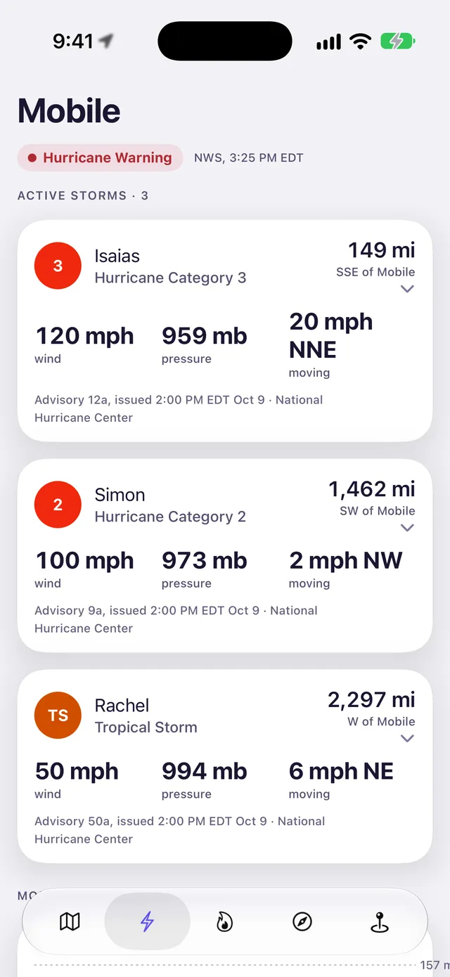
Every storm out there now. And every one since 1851.
Every active storm, with its winds, pressure and heading. Then the storms that came closest to your place, all the way back.
Closest ever to Mobile
Unnamed storm, 1944, tropical storm3.6 mi
Hanna, 2002, tropical depression7.6 mi
Baker, 1950, hurricane at its peak8.3 mi
From the Hurricane Center's record of every storm since 1851.
Hotspots
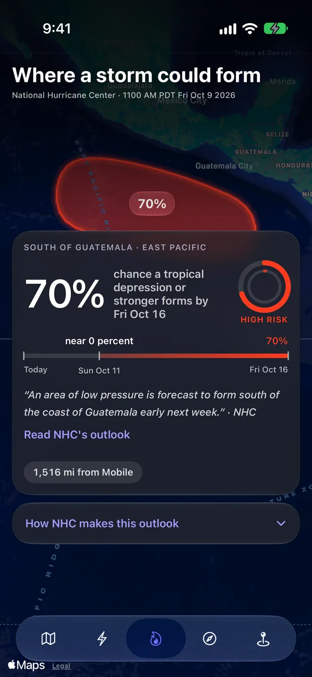
Where the next one could form.
The Hurricane Center's 7-day outlook, on a map: a 70% chance of a tropical depression or stronger south of Guatemala by Fri Oct 16.
Try it
Try it where you are.
Use your location, or type any place. See what the app would tell you about the nearest storm, right now.
Mobile, AL
149mi
Isaias is 149 mi SSE of Mobile.
Hurricane Warning and Storm Surge Warningin force
Winds of 39 mph or more reach207 mi from the center
NHC's most likely arrival of 39 mph windsFri 2 PM CDT
Chance of 39 mph winds in 5 daysmore than 90%
Example from Advisory 12a. Source: National Hurricane Center, National Weather Service.
Lock Screen
The answer on your Lock Screen.
Every alert says which place, what time, and who said so. While a storm closes in on a saved place, its distance stays on your Lock Screen and in the Dynamic Island.
Friday, October 9
9:41
Isaias, 120 mph149 mifrom Mobile, SSE
Hurricane Warning: Mobile nowIn force until 9:15 PM CDT. Isaias: 120 mph, 149 mi SSE. Source: National Weather Service.
Mobile: 58 mph gusts from 5 PM CDT 2m agoPeak 59 mph at 5 PM CDT. Last 39 mph gust 12 AM CDT. Source: National Weather Service.
Isaias is now a Category 3 hurricane 1h agoMaximum winds 120 mph (105 kt) at Advisory 12a. Source: National Hurricane Center.
Example. Alerts can be late or missed.
Free
Free. No ads. Nothing to buy.
The forecasts are public. We think the answers should be too. No account needed.
Every tropical storm on Earth. Each number shows the advisory or warning it came from.
National Hurricane CenterAtlantic, East and Central Pacific. Where the storm is, where it's heading and how strong it is. When the wind arrives, and how likely it is. Every Atlantic storm since 1851.
National Weather ServiceUnited States. The watches and warnings for your county. Gusts hour by hour, rain and river crests.
Joint Typhoon Warning CenterWest Pacific typhoons, North Indian Ocean and Southern Hemisphere cyclones: track, intensity, wind radii.
Not an official product of NOAA, the National Hurricane Center, the National Weather Service, the U.S. Navy or the Joint Typhoon Warning Center, which do not endorse it.
FAQ
Is it really free?
Yes. Every feature. No ads, no account.
Where do the numbers come from?
Atlantic and Pacific hurricanes, their cones, arrival times and wind chances: the National Hurricane Center. Typhoons and cyclones elsewhere: the Joint Typhoon Warning Center. Warnings and gusts: the National Weather Service. Radar and tides: NOAA.
Which storms does it cover?
Every tropical storm on Earth: hurricanes in the Atlantic and the Pacific, typhoons in the West Pacific, cyclones in the Indian Ocean and the Southern Hemisphere. Distance, Compass and alerts work anywhere. Watches, warnings and the hour-by-hour forecast for a place are for the United States. Storm history goes back to 1851 in the Atlantic.
How often does it update?
Every time the Hurricane Center updates, usually every 6 hours, more often as a storm nears land. You always see which advisory you're looking at and when the next one is due.
How many alerts will I get?
Never more than 6 a day, and only for places you save.
Does it need Location Services?
No. Type any place. Turn it on and the app also measures from where you are.
Is it an official warning service?
No. It shows what the Hurricane Center and the Weather Service publish. For what to do, follow your county's emergency management office.
When is it on the App Store?
Soon.
Hurricane: Storm Tracker
Coming soon to iPhone
Hurricane: Storm TrackerComing soon to iPhone. Free.